Before you cast off it tells you where to anchor and how much water there is. Under way: the bearing, the ETA and a line that stays clear of land. By the time you tie up again, the log is already written.

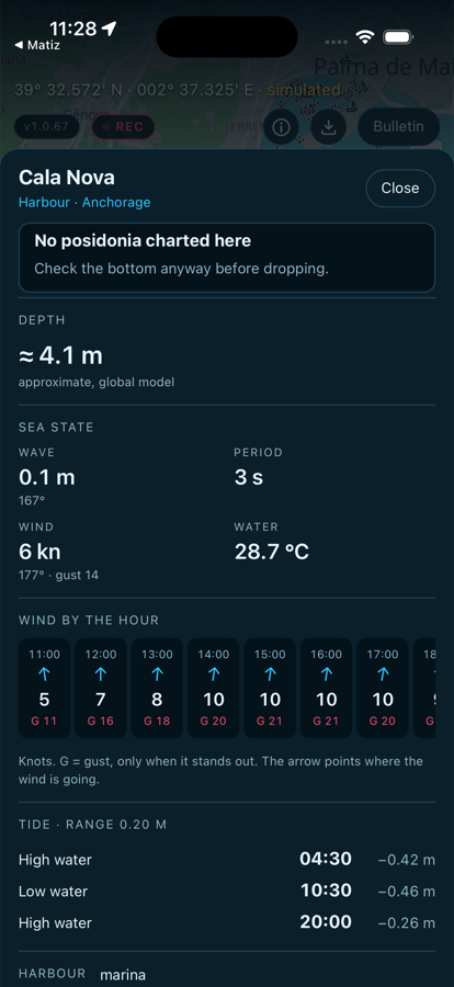
What is there — cove, anchorage, harbor — how much water there is, how the sea and the wind will be hour by hour, and when high tide is.
And if the bottom is Posidonia seagrass, it warns you: in the Balearics it is protected under Decret 25/2018 and anchoring on it is fined. It also flags marine reserves and any gale warnings in force.

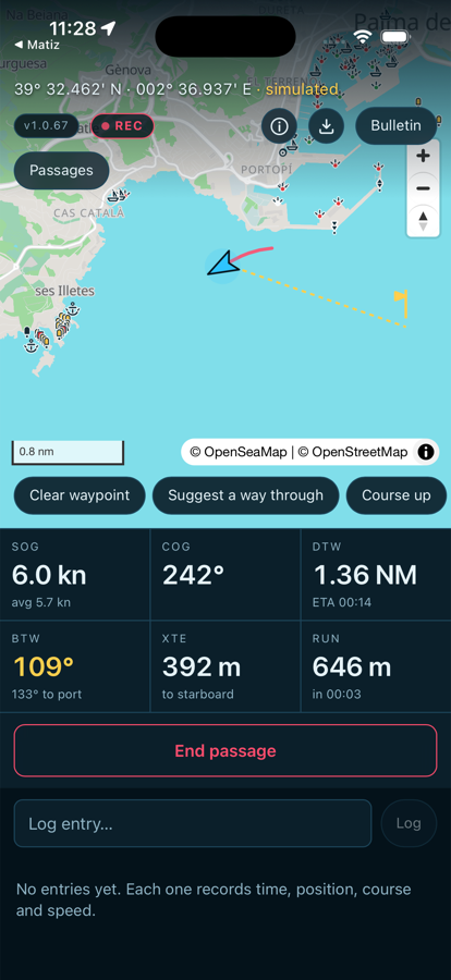
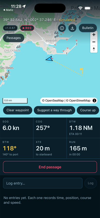
Set a waypoint and you have what you need to steer: the bearing to hold, how far off track you are, the miles run and what time you arrive — based on your actual average speed, not an optimistic guess.
If you are following the line in steps, alongside the leg you are on you still see how far it is to the destination itself. And you can change the waypoint halfway across: everything is worked out again.

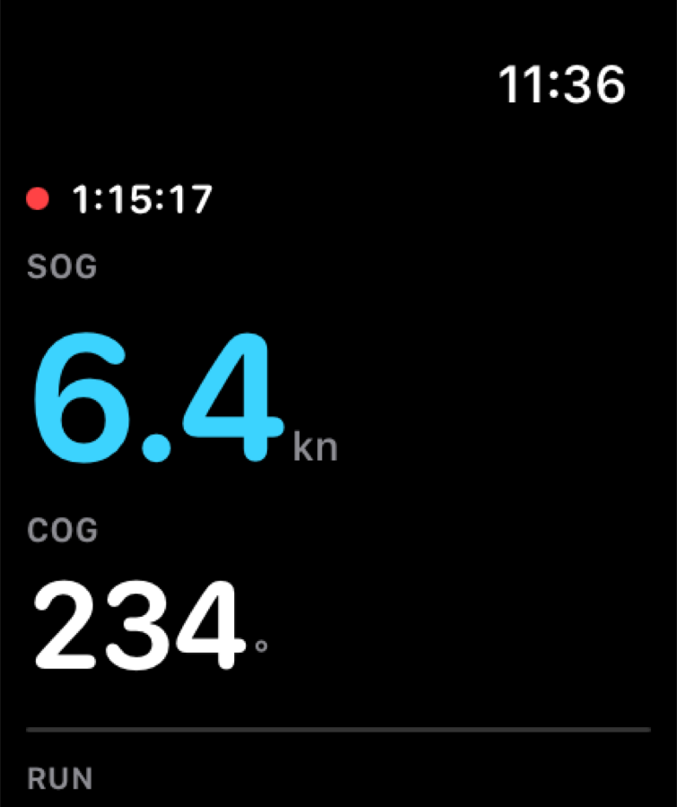
The Apple Watch shows what you need while you steer: speed, course, position, distance run and the ETA. Large numbers, readable at a glance with the sun in your eyes and one hand busy.
You can also start and stop the passage from the watch, so the phone can stay in your pocket the whole way. While a passage is running, the watch screen stays awake.
If you do not have an Apple Watch, Offing works exactly the same. The watch is a bonus, not a requirement.

Offing proposes a broken line that goes around the coast and tells you how much longer it is than the straight one. You can follow it in steps: the bearing and the ETA switch to the next waypoint — which advances on its own as you pass it — and you still see how far the destination is.
It says so plainly before drawing it: all it knows is where land is. It knows nothing about depths, shoals, cables or fish farms. It gives you a rough idea of the way to go, not a course to steer.
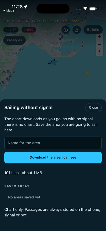
Offing carries its own charts. You download the area over wi-fi in port, and from then on the chart is drawn by the phone itself: zoom in, pan around, tap for detail — without a single bar of signal.
The iPhone GPS needs no data connection. That is why the passage keeps recording in airplane mode, miles offshore and with the screen off.

Every passage is kept complete: the track drawn on the chart, the miles, the hours, which port to which. On top of that go your entries — each with its time and its position — and the photos from that day.
Pick a date range and you get the logbook as a PDF — to keep, print or send. And each passage as GPX if you want it somewhere else.
Buoys, cardinals, lights, wrecks and rocks in the symbols you already read. Charts from OpenSeaMap and OpenStreetMap.
If you forget to stop and the track wanders inland, it warns you and closes the passage for you.
The chart turns with you, like a plotter. Or north up, if you prefer.
The figures on your wrist and the start and stop buttons. And with no watch, the app works exactly the same.
Whatever you write is saved with its time and position. Photos go inside that day’s passage.
Download the area in port and the chart works just the same ten miles offshore, in airplane mode.
The charts come from OpenSeaMap and OpenStreetMap. They are an aid, not an official nautical chart: no reliable soundings, and not corrected by any hydrographic office.
Do not use it to decide courses, passages or anchorages. Always carry the official chart on board, and the navigation equipment the regulations require.
We say it here, and the app says it again the first time you open it. We would rather you know exactly what you are buying.
No subscription, no account, nothing to cancel at the end of the season.